Understand the bridge
A working railway, a Victorian achievement and a crossing shaped by more than 150 years of care.
Start here
The bridge in brief
Barmouth Bridge crosses the Mawddach Estuary between Barmouth and the southern shore near Morfa Mawddach.
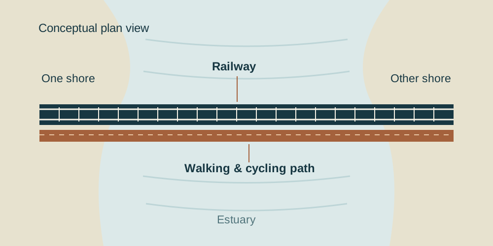
The single-track railway runs beside a path used by walkers and cyclists. Timber trestles, steel spans and the former opening section reveal how railway engineering met the demands of a tidal estuary.
Opened in 1867 and listed Grade II*, it remains part of everyday life. Its story includes ambitious construction, shipping, fire, marine borers and the major restoration completed in 2023.
- Opened
- 1867
- Heritage status
- Grade II*
- Major restoration
- 2020–2023
Go further
Six chapters of the bridge
Open a chapter for a closer look, or follow the links into the detailed guides.
011864–1867 · Railway ambitionBuilding the crossing
The bridge was built for the Aberystwyth and Welsh Coast Railway’s route between Aberystwyth and Pwllheli. A direct estuary crossing connected the railway along the coast; the bridge became a link between communities as well as an engineering landmark.
Work began in 1864, in difficult tidal conditions. The council records that two men drowned during construction—a reminder of the human cost behind the familiar view.
There were two opening milestones in 1867: horse-drawn carriages on 3 June and locomotives on 10 October. This is why accounts can give different opening dates without necessarily contradicting one another.
Source: Barmouth Town Council.
Follow the chronology02Timber · Steel · TidesHow the bridge works
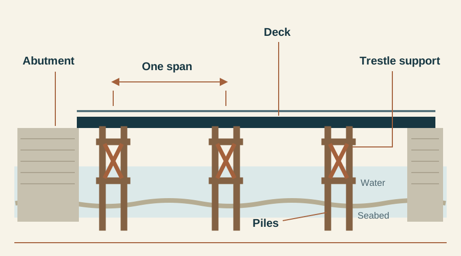
Most of the crossing is a succession of short timber spans. Rather than one enormous arch, repeated supports carry the deck across the estuary. A “pile bent” is a group of piles forming a support; a “span” is the distance between supports. The terms describe different parts of the structure.
Cadw’s record describes longitudinal timbers beneath the deck and rails, with cross-braced piles and inclined supports. In structural terms, the deck passes weight into the supports, while bracing helps the framework resist sideways movement.
The northern steel section looks different because it incorporated a movable crossing for shipping. The lower pedestrian walkway lies on the upstream side of the railway. Look from the shore to see the contrast between repeated timber trestles and the taller metalwork.
Source: Cadw’s listed-building record.
Read the engineering guide03From drawbridge to swing spanA bridge that could open
A railway across an estuary also had to accommodate vessels. The original “cock and draw” arrangement near Barmouth opened a passage through the bridge. After underwater ironwork was found to be badly corroded in 1899, the northern section was rebuilt using steel.
A later swing span allowed ships to pass by turning aside, rather than lifting a deck. The Town Council records its last opening in 1987. The opening section belongs to the bridge’s maritime history as much as its railway story.
Source: Barmouth Town Council.
Explore the opening section04The work behind a lasting landmarkFire, decay and survival
A long-lived timber bridge depends on inspection, repair and renewal. Fire threatens the material above the water; decay, corrosion and marine borers can affect parts that a visitor cannot readily see.
In 1980, divers discovered Teredo damage in the timber. These marine borers tunnel inside wood, so the extent of damage is not necessarily apparent from the outside. Major repairs followed during the 1980s.
The reported 1892 fire story centres on a boy named Owens who raised the alarm. The dedicated account distinguishes the reported incident from details of his identity that remain unverified. The people who noticed problems, responded and repaired the crossing are part of its history too.
Further reading: repair history and the reported Owens account.
Explore the survival story052020–2023 · £30 millionThe great restoration
Network Rail’s four-year programme renewed the crossing while retaining its historic appearance. Inspections revealed more severe timber decay and metal corrosion than initially expected. Work was divided into four shorter closures to reduce the disruption of a prolonged shutdown.
During the final phase, two new metallic spans, each weighing 160 tonnes, were moved into position. A practice run on a purpose-built mock track preceded the operation. Gantry hoists named after the original designers, Henry Conybeare and Benjamin Piercy, helped remove old elements and install new ones.
The Cambrian line reopened on 2 December 2023; the completion celebration followed on 8 December. Restoration secured a working railway bridge and public crossing, while preserving the form that makes the viaduct recognisable.
Source: Network Rail’s completion announcement.
Source: Network Rail’s October 2023 engineering update.
See what was renewed06Facts · Records · Open questionsReading the evidence
Not every published figure uses the same definition. Network Rail describes a 770-metre structure, while other accounts give about 820 metres. Cadw’s historic listing gives another measurement. Without a common surveyed boundary, these figures should not be treated as interchangeable.
The same care applies to span counts: the original arrangement, the later metal section and the present bridge belong to different dates. A count of timber supports is also not automatically a count of every span.
Use the facts page for concise answers and the archive for source links. Cadw provides the heritage description; local history adds people and context; Network Rail records the modern works. The Owens account is presented with its remaining research questions.
Read facts and questionsThe full guide
Explore by subject
Experience the crossing